Authentic General Plan Land Use Change Letters

The county is working on purchasing 81 acres for Open Spaces. This is the way to take land.

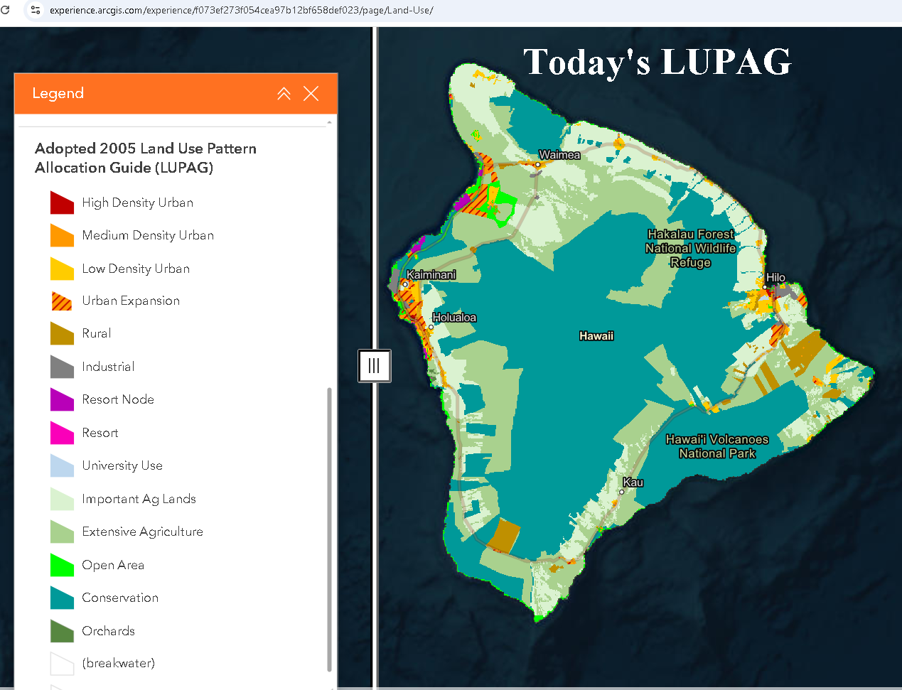
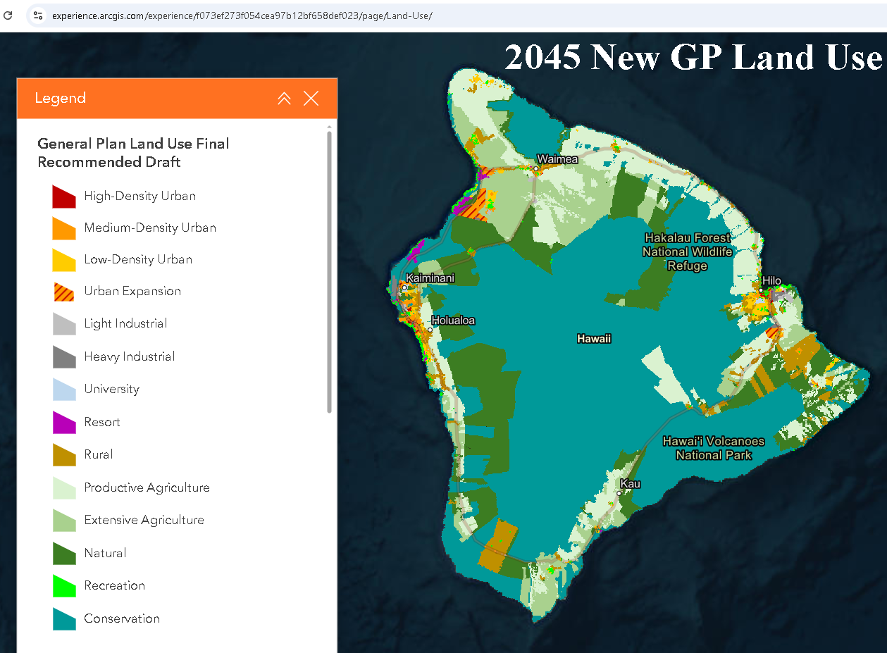
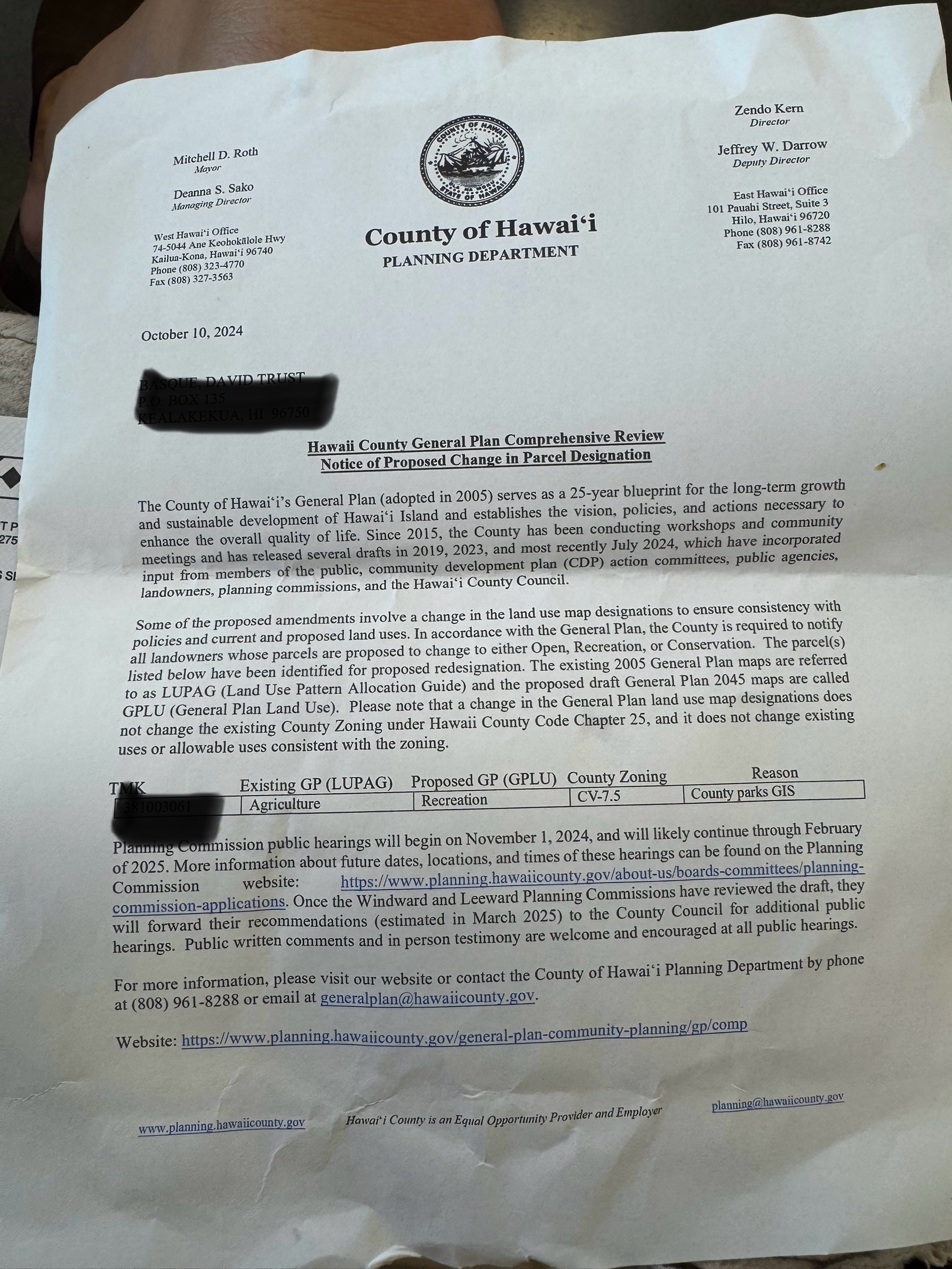
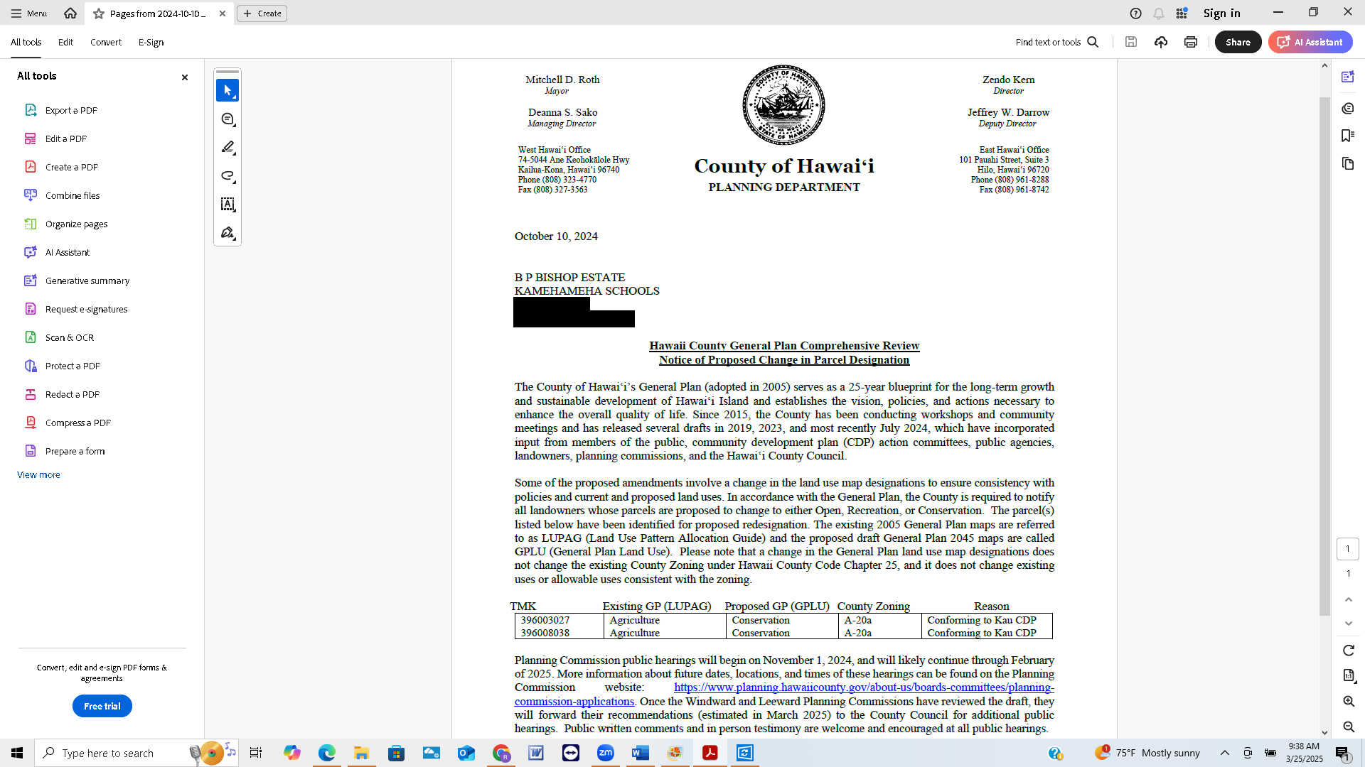
Hawai'i Planning is trying to take land in the future by changing long-range Land Use to Conservation. 

We are in the Comment Period for 2045 General Plan

You Can Give Testimony Today on the 2045 General Plan

You can email your testimony about the 2045 General Plan's Land Use Designation Changes by emailing the County Council.

Copy and Paste Email ALL Addresses:

lpctestimony@hawaiicounty.gov, wpctestimony@hawaiicounty.gov, cdp@hawaii.gov, GeneralPlan@hawaiicounty.govrebecca.villegas@hawaiicounty.gov, heather.kimball@hawaiicounty.gov, jennifer.kagiwada@hawaiicounty.gov, dennis.onishi@hawaiicounty.gov, ashley.kierkiewicz@hawaiicounty.gov, matt.kanealii-kleinfelder@hawaiicounty.gov, michelle.galimba@hawaiicounty.gov, holeka.inaba@hawaiicounty.gov, james.hustace@hawaiicounty.gov, 

In their 2045 General Plan Page 83 https://www.planning.hawaiicounty.gov/home/showpublisheddocument/308136/638597487229830000

“Purpose and Authority of the General Plan Land Use Map

The designated land uses are delineated on the General Plan Land Use Map. The broad-brush boundaries indicated are graphic expressions of the General Plan policies, particularly those relating to land use. They are forward-looking, long-range guides..."

https://www.planning.hawaiicounty.gov/resources/resources-references/zoning-land-use

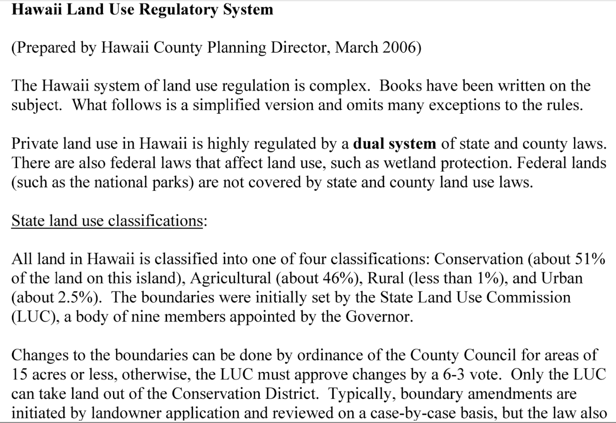
"Hawai‘i Land Use Regulatory System

A simplified explanation of Hawai‘i’s complex system of land use regulation, which involves State Land Use classifications, County Zoning districts, General Plan designations, and more."

https://records.hawaiicounty.gov/weblink/DocView.aspx?dbid=1&id=56156&cr=1
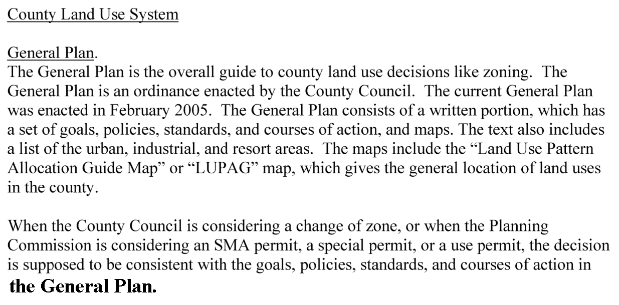
“When the County Council is considering a change of zone, or when the Planning  Commission is considering an SMA permit, a special permit, or a use permit, the decision is supposed to be consistent with the goals, policies, standards, and courses of action in the General Plan, and also consistent with the LUPAG map. This means, for example, if the LUPAG map shows an area as “Open”, the County Council should not approve a rezoning to allow a hotel in the area, without first amending the General Plan. Amendments to the General Plan can be initiated by the Planning Director or the Council, and must be approved by the Council by ordinance.”

Why is Hawai'i Planning changing so much Long-Range Land Use Designations?

Why are they changing so much land to Conservation land in their General Plan?

Is it legal to change Land to Conservation Land in the General Plan's Long-Range Designation? This is not voluntary on the part of the landowners. 

https://mylandplan.org/content/facts-and-myths-about-conservation-easements

“Fact:  A conservation easement or conservation agreement is a voluntary conservation option. It sets up a legal arrangement between a landowner and a government agency or land trust that ensures the land will never be developed. The land remains the private property of the landowner, who gets to decide what kinds of activities will be allowed or disallowed on the property.”

https://gokcecapital.com/conservation-easements-pros-and-cons/ 

"A conservation easement is a voluntary agreement that permanently limits the use of the land to protect its conservation values."

Is changing a Long-Range Designation land to Conservation the same as a Conservation Easement?

https://www.hawaiilife.com/blog/conservation-purchase-or-conservation-easement-two-preservation-strategies/

"Conservation purchase, conservation easement, conservation zoning, or state land use designation — all of these “conservation” terms refer to strategies used to protect or limit permitted uses on real estate.

When a conservation easement is established, the owner of the land still owns and controls the land, but has voluntarily given up certain rights or uses in favor of a conservation purpose."


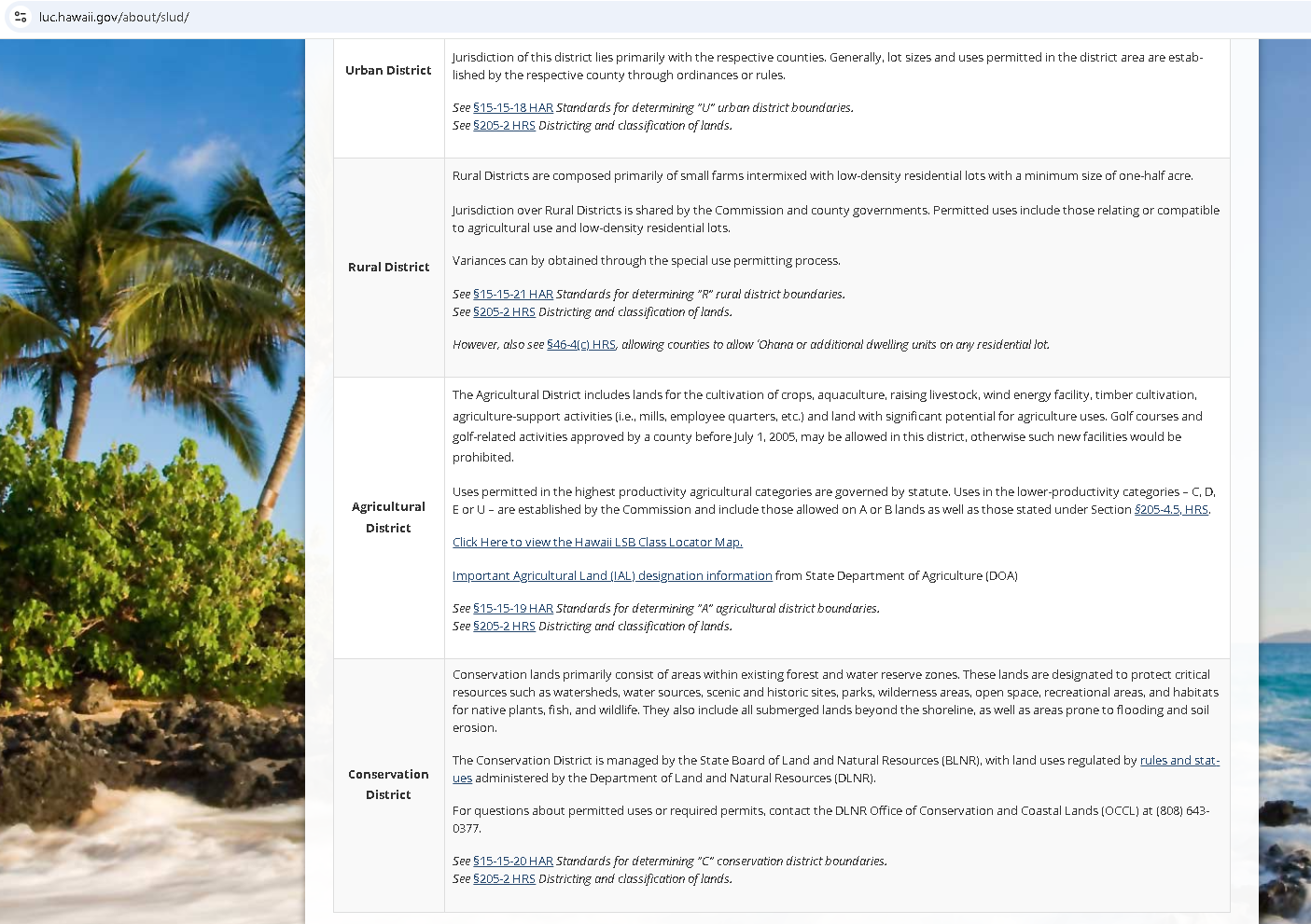
Understanding Land Use Designations:

https://dhlandmanagement.com/index.php/2021/03/24/land-use-designation-codes/

"– Land use is a process of organizing the use of land to meet occupant’s needs while respecting the capabilities of the land. Land use planning balances private property rights with the desired community character. 

Land management is done through the use of land use designations (LUD’s). Land use designations specify ways of managing an area of the land and the resources it contains. LUD’s emphasizes on certain resources or combination of resources. The LUD’s are assigned or allocated to specific areas of land corresponding to compatible zoning districts. "

https://jbpro.com/land-use-and-zoning/

"The Connection between Future Land Use and Zoning Future land use policies and zoning regulations work in tandem to create a full picture of how land will be used."

https://records.hawaiicounty.gov/Weblink/1/edoc/139690/2024-10-03%20Puna%20CDP%20GP%20QA.pdf

“When someone applies for a rezone, they are requesting to change the zoning district of their property to allow different uses within the framework established by the General Plan..”

Why is Hawai’i Planning changing Long-Range Land Use? 

I tried researching what will happen to land that has their Land Use changed from agricultural to conservation, and all I could find was this information:

https://files.hawaii.gov/dbedt/op/gis/data/hawctylupag.pdf

“LUPAG (Land Use Pattern Allocation Guide)

The plan consisted of twelve major elements ranging from economic activities to historic sites to lands use which were further broken down into sub-elements. Goals, policies, standards, and courses of action were set forth for each element of the General Plan. The goals are general expressions of the desired long-range direction and situation for the island. Policies state the method or strategy, which should be undertaken in order to attain the goals. The quality and quantity by which we can measure or evaluate conditions are the standards of the elements. Courses of action are more precise or detailed discussions of alternative solutions for community concerns and problems.”

https://records.hawaiicounty.gov/Weblink/1/edoc/139690/2024-10-03%20Puna%20CDP%20GP%20QA.pdf

GPLU (General Plan Land Use)

“Who is responsible for changing zoning?

It is typically up to the property owner to apply for a change of zone. The General Plan does not change any landowner’s existing zoning. While the General Plan Land Use (GPLU) designations suggest the best and highest use of the land, the zoning remains the same.

The General Plan outlines the maximum allowable land use for a particular area. What does it mean when someone applies to rezone their land?

 A: When someone applies for a rezone, they are requesting to change the zoning district of their property to allow different uses within the framework established by the General Plan. The plan defines the upper limits of land use, and rezoning seeks to align specific property uses within those limits.”

https://www.landsearch.com/blog/land-use-types-definitions

 “Why does land use matter?

 Let’s say you’re trying to sell your land. Land usage also matters because it can be a major determining factor in the value of the property…”

https://www.landsearch.com/blog/land-use-types-definitions

 “Land usage definition

Land use describes the relationship between people and land. It’s what it sounds like—how a piece of land is being used. It’s the intent people apply to the land available to them. A more specific land use definition is the characterization of actions people apply to land for various purposes. This is often dictated by the natural resources the land provides and historical use. It can also be enforced from various jurisdictions in an effort to control real estate development and for future land use planning.”

https://en.wikipedia.org/wiki/Land_use

Land use is an umbrella term to describe what happens on a parcel of land. It concerns the benefits derived from using the land, and also the land management actions that humans carry out there.”

https://luc.hawaii.gov/about/history-3/

 "The State Land Use Law (Chapter 205, Hawaiʻi Revised Statutes) is unique in the history of Hawaiʻi land use planning.  Originally adopted by the State Legislature in 1961, the Land Use Law establishes an overall framework of land use management whereby all lands in the State of Hawaiʻi are classified into one of four land use districts...

 PURPOSE OF THE LAW

In 1961, the Hawaiʻi State Legislature determined that a lack of adequate controls...

...and the conversion of prime agricultural land to residential use, were key reasons for establishing the state-wide land use system.

To administer this state-wide land use law, the Legislature established the Land Use Commission. The Commission is responsible for preserving and protecting Hawaiʻi’s lands and encouraging those uses to which lands are best suited.

COMPOSITION OF THE COMMISSION

The Commission is composed of nine members, who are appointed by the Governor and confirmed by the State Senate. One member is appointed from each of the four counties. Five members are appointed at-large. Commissioners are non-paid volunteers who represent a cross-section of the community.

ROLE OF THE COMMISSION

The Commission’s primary role is to ensure that areas of state concern are addressed and considered in the land use decision-making process.

The Commission establishes the district boundaries for the entire State. The Commission acts on petitions for boundary changes submitted by private landowners, developers and State and county agencies. The Commission also acts on requests for special use permits within the Agricultural and Rural Districts."

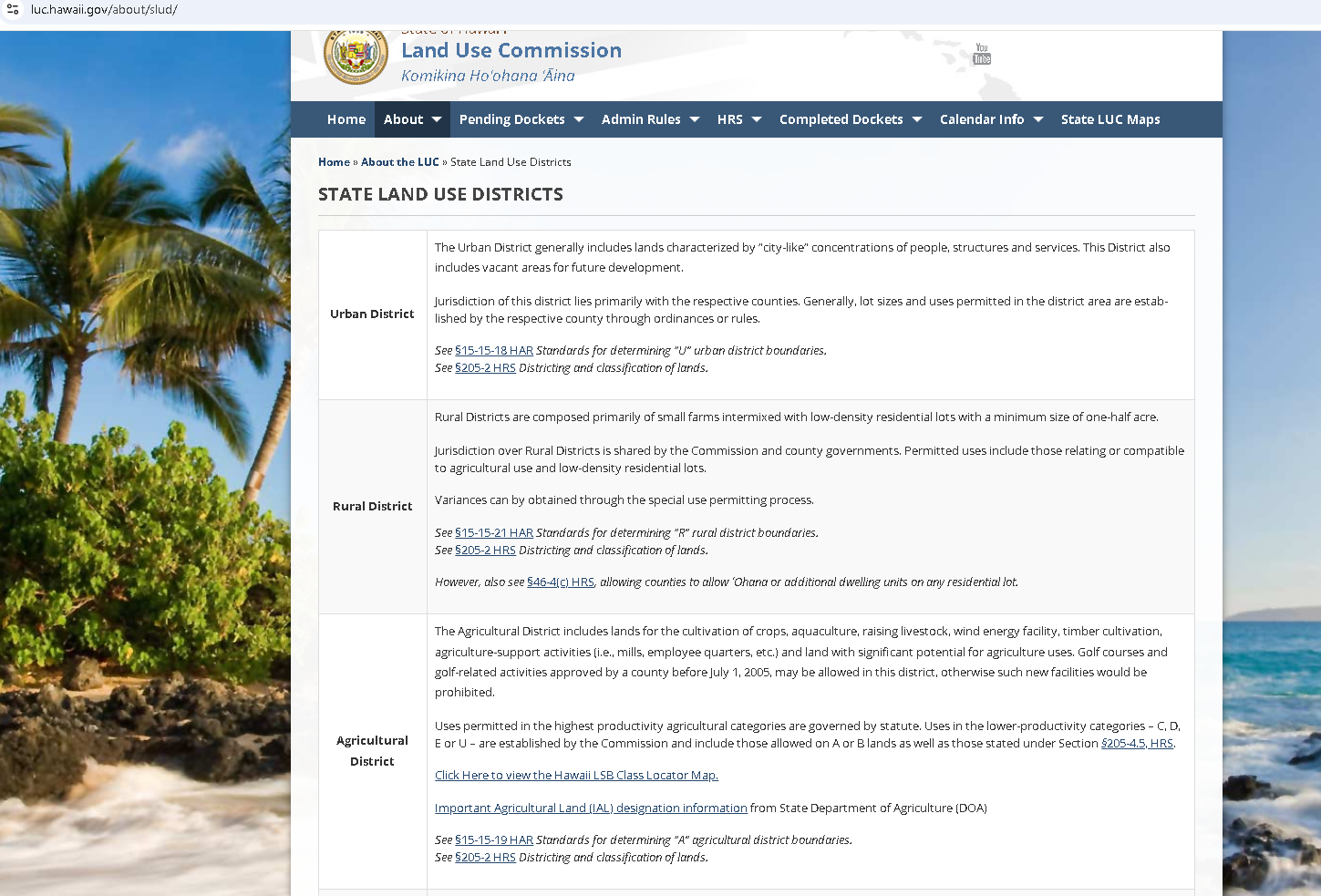
Go to Land Use Districts Definitions link  https://luc.hawaii.gov/23182/ to learn what the districts mean.


Go to the General Plan Research Page Above to learn more about the 2045 General Plan.

Thank you for your time and efforts to help others and keep our way of life.